Whales and the gulf
Humpbacks of the north coast
Humpbacks travel north each spring from warm breeding waters to feed off Cape Breton. Around Pleasant Bay and Bay St. Lawrence they lift their flukes, slap their flippers and now and then breach.
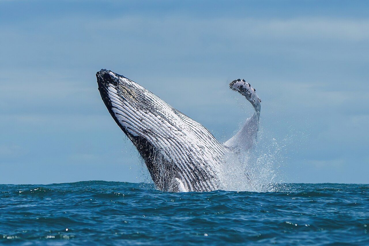 Photo by Giles Laurent; CC BY-SA 4.0 (source file)
- Getting there
- Cabot Trail north to Pleasant Bay
- Bring
- Binoculars, a camera with zoom, windproof layers
- At sea
- The northern capes catch wind and swell from two directions; mornings are often calmer, and fog can roll in fast in early summer.
- From Chéticamp
- About 45 minutes north to Pleasant Bay
Of all the whales in the Gulf of St. Lawrence, the humpback is the one that seems to put on a show. It lifts its tail high before diving, it slaps the water with flippers almost a third as long as its body, and sometimes it hurls nearly its whole bulk into the air. The northern tip of Cape Breton, from Pleasant Bay round to Bay St. Lawrence and Cape North, is one of the places on the island where you have a real chance of seeing it.
A long journey north
Humpbacks in the western North Atlantic spend the winter in warm Caribbean waters, where they mate and give birth. In spring they move north to colder, richer seas to feed, spreading out along the coasts of New England, Atlantic Canada, Greenland and beyond. The trip covers thousands of kilometres, and the whales eat little until they reach their summer grounds.
Off Cape Breton the first humpbacks usually arrive in early summer, and sightings often build through late summer and into the autumn. Numbers vary a great deal from year to year, following the fish they feed on. After the end of commercial whaling, humpback numbers in the North Atlantic recovered strongly, and today they are a familiar sight in many places where they were once rare.
What to look for
An adult humpback is roughly 12 to 16 metres long, dark on the back, with knobbly bumps on the head and long white or partly white flippers. The blow is bushy and can rise a few metres. Before a deep dive the whale arches its back, which is where the name comes from, and then lifts its broad tail flukes clear of the water as it goes down.
The surface behaviours are what most people hope for. A breach, when the whale launches upwards and crashes back down, can be seen from a long way off as a sudden white explosion. Flipper slapping and tail slapping, sometimes repeated dozens of times, make a sound you can hear across calm water. Nobody knows for certain why humpbacks breach. Ideas include communication, play, and shaking off parasites, and the reasons may differ from one occasion to the next.
Humpbacks feed on small schooling fish and krill. In the North Atlantic they sometimes blow rings or clouds of bubbles beneath a school, then rise through the middle with their mouths open. If you see seabirds suddenly diving in a tight patch, keep watching that spot.
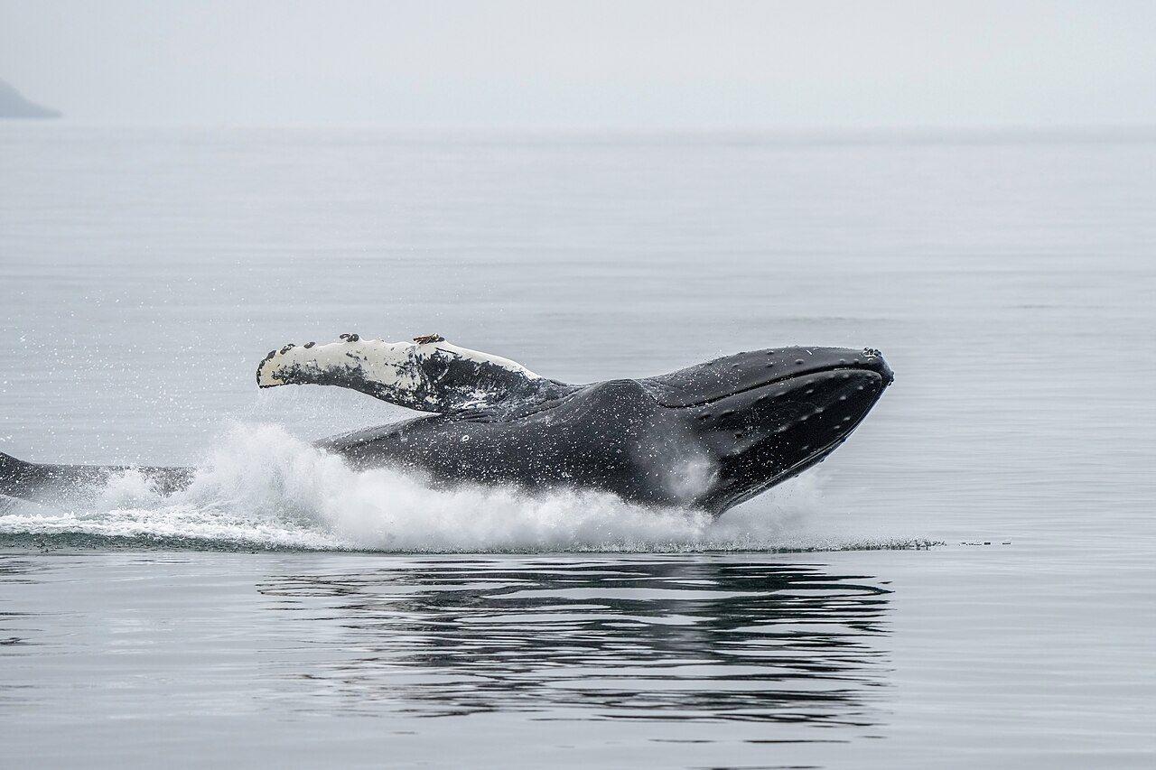 Photo by Giles Laurent; CC BY-SA 4.0 (source file)
Reading the flukes
The underside of a humpback's tail is patterned in black and white, and the trailing edge is notched and scalloped in its own way. No two are alike. Researchers photograph flukes as the whales dive and match them against large catalogues of known animals, which is how much of what is known about humpback migration was worked out. A whale photographed in the Caribbean in winter can be matched with the same animal off Atlantic Canada in summer.
Further along the coast: Minke and fin: the gulf's two rorquals
If you take photographs, try to catch the fluke straight on as it rises, with the underside facing you. Even from a cliff top, a long lens can sometimes record enough of the pattern to be useful. Some research groups invite the public to share fluke photos; if you have a clear one, it is worth asking a park interpreter where it could go.
The northern coast
Pleasant Bay sits at the foot of MacKenzie Mountain on the western side of the Cabot Trail, where the road drops out of the Highlands to the sea. The bay faces west over deep water, and the harbour and nearby headlands are good spots to stand and scan. The village has a small whale interpretive centre with exhibits on the species found offshore.
From Pleasant Bay the trail climbs North Mountain and drops into the Aspy valley. A side road leads north from Cape North towards Bay St. Lawrence, a working fishing harbour near the top of the island, and on to Meat Cove at the end of the road. The water off these northern capes is where the gulf meets Cabot Strait, and humpbacks, minkes and pilot whales all pass through. The drive is covered in Pleasant Bay to Meat Cove.
Around the top of the island, Cape North and the shores of Aspy Bay look east and north over open water, and on a clear day you can make out St. Paul Island offshore, a rocky island long known to sailors for its shipwrecks. The currents and upwellings where the gulf meets the strait bring food close to the surface, which is part of why whales gather here. Seabirds are a useful guide: a raft of shearwaters or a cluster of diving gannets often means fish, and humpbacks are rarely far from fish.
Weather changes quickly up here. A clear morning in Pleasant Bay can become thick fog by noon, and wind can raise whitecaps that hide any spout. Give yourself more than one chance if you can.
Watching without crowding
A breaching humpback is exciting, and that is exactly when boats tend to push too close. Canadian rules set minimum approach distances for whales and make disturbing them an offence. Keep well back from a whale that is breaching or slapping, since a heavy animal landing on the water does not look where it falls.
From land there is no such worry. A good pair of binoculars, a calm day and a high viewpoint such as the headland at the end of the Skyline Trail give you every chance of seeing flukes rise and fall far below.
Back along the coast: Gulf of St. Lawrence · Further on: Gulf of St. Lawrence · Same stretch: Gulf of St. Lawrence, Gulf of St. Lawrence, Gulf of St. Lawrence, Cape Breton Highlands, Anywhere · the whole coast · logbook